Northern and Central South America: Geographic Passport


Northern and Central South America: Geographic Passport
Students are introduced to the physical geography of Northern and Central South America. They identify the countries in this region and explore a map with political, physical, population, and climate layers, and compare and contrast the countries. Then they select two countries and compare and contrast their natural resources as well as the impact of those resources on the economy. Finally, they do independent research on environmental issues in the region.

This learning experience is designed for device-enabled classrooms. The teacher guides the lesson, and students use embedded resources, social media skills, and critical thinking skills to actively participate. To get access to a free version of the complete lesson, sign up for an exploros account.

1:1 Devices
Teacher Pack

The Pack contains associated resources for the learning experience, typically in the form of articles and videos. There is a teacher Pack (with only teacher information) and a student Pack (which contains only student information). As a teacher, you can toggle between both to see everything.

Here are the teacher pack items for Northern and Central South America: Geographic Passport:

Preview - Scene 1
Exploros Learnign Experience Scene Navigation


Engage


Overview

In this experience, students are introduced to the physical geography of Northern and Central South America. They identify the countries in this region and explore a map with political, physical, population, and climate layers, and compare and contrast the countries. Then they select two countries and compare and contrast their natural resources as well as the impact of those resources on the economy. Finally, they do independent research on environmental issues in the region.

The Northern and Central South American countries in this region include:

  • Ecuador
  • Colombia
  • Venezuela
  • Guyana
  • Suriname
  • Uruguay
  • Paraguay
  • Bolivia

Objectives:

  • Identify major geographic features of Northern and Central South America.
  • Describe the impact of physical geography on human settlement patterns and land use patterns.
  • Describe major environmental problems that face the region today.


The northern part of South America has a number of small countries that you may not have heard of. Some are prime vacation destinations because of their location on the Caribbean Sea. In this experience, you will learn about the geography of these countries and others from the region.

Objectives:
  • Identify major geographic features of Northern and Central South America.
  • Describe the impact of physical geography on human settlement patterns and land use patterns.
  • Describe major environmental problems that face the region today.


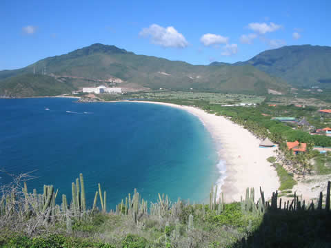
sandy beach with mountains in the distance

Margarita Island, Venezuela


The movie is 5:32 minutes long. Have the students watch at least the first 2:30 minutes.


What do you already know about South America? Watch this video to see many landscapes of this continent.

Three of the countries visited in the video—Bolivia, Uruguay, and Paraguay—are in the region of Northern and Central South America, which is the subject of this experience.

Take a look at this map of the Northern and Central region of South America.


How many of the countries can you name? Label any that you can identify.


Share your answers with a classmate and see if together you can name any more.


When everyone is ready to continue, unlock the next scene.


End of Preview
The Complete List of Learning Experiences in Central America Unit.
Would you like to preview the rest of this learning experience, and get access to the entire functioning World Geography course for your classroom? Sign up using your school email address below.
Back to top