
The Pack contains associated resources for the learning experience, typically in the form of articles and videos. There is a teacher Pack (with only teacher information) and a student Pack (which contains only student information). As a teacher, you can toggle between both to see everything.
Here are the teacher pack items for The Middle East: Background of the Conflict:


Overview In this experience, students watch an introductory video and predict how large the state of Israel is by comparing it to a U.S. state. Then they watch another video about the British mandate period. Next they study a series of maps of proposed partitions and observe the problems of dividing the territory between two nations. Finally they learn about the Palestinian refugees displaced since 1948. Students will collaborate in small groups for scene 4. This lesson is based on lesson plans from Teaching the Arab-Israeli Conflict by the Institute for Curriculum Services. The videos run approximately 5 minutes each. Together they can serve as a summary for the World History course, examining how the roots of the Middle East conflict have been influenced by major events throughout history—the Babylonian Empire, the Roman Empire, the spread of Islam, the French Revolution and rise of nationalism, European imperialism and artificial borders, the World Wars, etc. Objective
The region known as the Middle East acts as a land bridge connecting Asia, Africa, and Europe. This geographic location gives it strategic importance in political, economic, and cultural activities. The area encompassing the state of Israel and the Palestinian Territories (the West Bank and the Gaza Strip) is holy to the three monotheistic religions: Judaism, Christianity, and Islam. This small region is the source of an ongoing conflict that affects world politics. In this experience you will learn some of the historical and geographical background to the Israeli-Palestinian conflict.
Objective

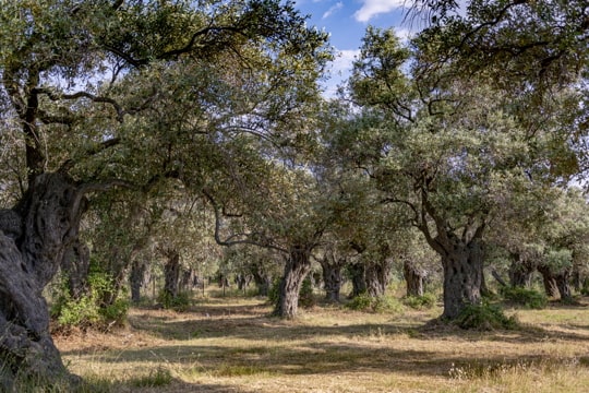
Ancient olive groves tie both Israelis and Palestinians to the land.
Watch the video Land Matters, which discusses how two peoples both consider the same land as their homeland.
How big do you think the state of Israel is? Answer by naming a state within the United States that you think is approximately the same size.
Israel is roughly the size of New Jersey, which is the third smallest state. Students are often surprised to learn how small the area of Israel is. The total area of the State of Israel is 22,145 sq.km (8,630 sq. miles), of which 21,671 sq. km is land area. Israel is about 420 km in length and about 115 km across at the widest point. At the narrowest point it is only about 10 km wide.
